
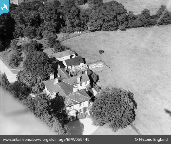
EPW059449 ENGLAND (1938). Manor House, Skellingthorpe, 1938
© Copyright OpenStreetMap contributors and licensed by the OpenStreetMap Foundation. 2026. Cartography is licensed as CC BY-SA.
Nearby Images (9)
EPW059449

EPW059447

EAW015698

EPW059452

EAW015699

EAW015697

EPW059448

EPW059451

EPW059450

Details
| Title | [EPW059449] Manor House, Skellingthorpe, 1938 |
| Reference | EPW059449 |
| Date | 15-September-1938 |
| Link | |
| Place name | SKELLINGTHORPE |
| Parish | SKELLINGTHORPE |
| District | |
| Country | ENGLAND |
| Easting / Northing | 492656, 371945 |
| Longitude / Latitude | -0.61159004693001, 53.236161400936 |
| National Grid Reference | SK927719 |
Pins
Be the first to add a comment to this image!