
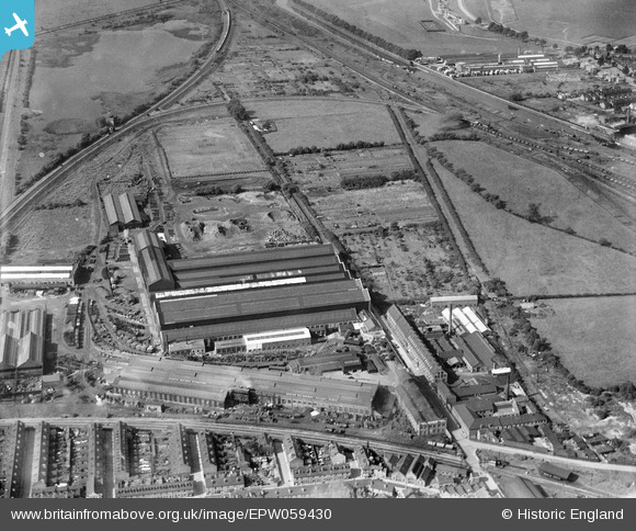
EPW059430 ENGLAND (1938). The Ruston-Bucyrus Ltd Spike Island Engineering Works, New Boultham, 1938
© Copyright OpenStreetMap contributors and licensed by the OpenStreetMap Foundation. 2026. Cartography is licensed as CC BY-SA.
Nearby Images (24)
EPW059430

EAW007115

EPW059429

EAW007120

EPW059432

EAW007127

EPW059426

EPW059431

EPW016180

EPW059425

EPW059427

EAW007122

EAW007126

EAW007119

EAW007124

EAW015717

EAW007123

EAW007125

EAW007116

EAW007117

EAW015718

EAW007121

EAW007114

EPW016181

Details
| Title | [EPW059430] The Ruston-Bucyrus Ltd Spike Island Engineering Works, New Boultham, 1938 |
| Reference | EPW059430 |
| Date | 15-September-1938 |
| Link | |
| Place name | NEW BOULTHAM |
| Parish | |
| District | |
| Country | ENGLAND |
| Easting / Northing | 496454, 370937 |
| Longitude / Latitude | -0.55500320540408, 53.22642617195 |
| National Grid Reference | SK965709 |
Pins
Be the first to add a comment to this image!