
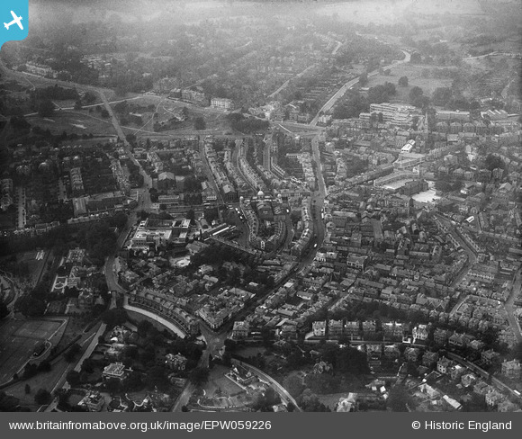
EPW059226 ENGLAND (1938). The town, Royal Tunbridge Wells, 1938
© Copyright OpenStreetMap contributors and licensed by the OpenStreetMap Foundation. 2026. Cartography is licensed as CC BY-SA.
Nearby Images (7)
EPW059226

EPW011454

EPW016894

EAW048710

EPR000439

EPW001432

EAW048709

Details
| Title | [EPW059226] The town, Royal Tunbridge Wells, 1938 |
| Reference | EPW059226 |
| Date | 11-September-1938 |
| Link | |
| Place name | ROYAL TUNBRIDGE WELLS |
| Parish | |
| District | |
| Country | ENGLAND |
| Easting / Northing | 558518, 139593 |
| Longitude / Latitude | 0.26590069055643, 51.133115640151 |
| National Grid Reference | TQ585396 |
Pins

Garry |
Monday 19th of August 2013 09:10:28 PM | |
|
Garry |
Monday 19th of August 2013 09:08:00 PM | |
|
Garry |
Monday 19th of August 2013 09:03:44 PM | |
|
Garry |
Monday 19th of August 2013 09:02:34 PM |