
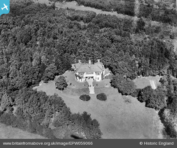
EPW059066 ENGLAND (1938). Franklin House, Ruislip, 1938
© Copyright OpenStreetMap contributors and licensed by the OpenStreetMap Foundation. 2026. Cartography is licensed as CC BY-SA.
Nearby Images (2)
EPW059066

EPW059065

Details
| Title | [EPW059066] Franklin House, Ruislip, 1938 |
| Reference | EPW059066 |
| Date | 2-September-1938 |
| Link | |
| Place name | RUISLIP |
| Parish | |
| District | |
| Country | ENGLAND |
| Easting / Northing | 508331, 189533 |
| Longitude / Latitude | -0.43591629591293, 51.59374312612 |
| National Grid Reference | TQ083895 |
Pins

Keith |
Monday 24th of June 2013 11:40:33 AM |