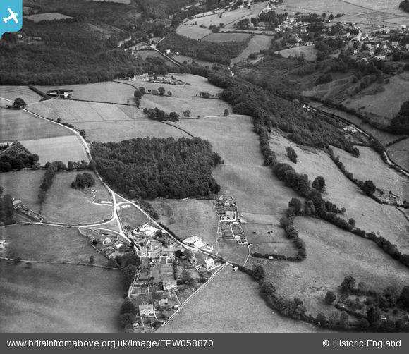
EPW058870 ENGLAND (1938). Stringer's Wood and Toadsmoor Valley, Quarhouse, 1938
© Copyright OpenStreetMap contributors and licensed by the OpenStreetMap Foundation. 2024. Cartography is licensed as CC BY-SA.
Nearby Images (7)
Details
| Title | [EPW058870] Stringer's Wood and Toadsmoor Valley, Quarhouse, 1938 |
| Reference | EPW058870 |
| Date | 17-August-1938 |
| Link | |
| Place name | QUARHOUSE |
| Parish | BRIMSCOMBE AND THRUPP |
| District | |
| Country | ENGLAND |
| Easting / Northing | 387390, 202883 |
| Longitude / Latitude | -2.1825811803166, 51.724068437057 |
| National Grid Reference | SO874029 |
Pins
Be the first to add a comment to this image!


![[EPW058870] Stringer's Wood and Toadsmoor Valley, Quarhouse, 1938](http://britainfromabove.org.uk/sites/all/libraries/aerofilms-images/public/100x100/EPW/058/EPW058870.jpg)
![[EPW058871] Stringer's Wood and Toadsmoor Valley, Quarhouse, 1938](http://britainfromabove.org.uk/sites/all/libraries/aerofilms-images/public/100x100/EPW/058/EPW058871.jpg)
![[EAW015792] The hamlet, Quarhouse, 1948. This image has been produced from a print.](http://britainfromabove.org.uk/sites/all/libraries/aerofilms-images/public/100x100/EAW/015/EAW015792.jpg)
![[EAW015791] The hamlet, Quarhouse, 1948. This image has been produced from a print.](http://britainfromabove.org.uk/sites/all/libraries/aerofilms-images/public/100x100/EAW/015/EAW015791.jpg)
![[EAW015794] Steepways Farm and the surrounding countryside, Quarhouse, 1948. This image has been produced from a print.](http://britainfromabove.org.uk/sites/all/libraries/aerofilms-images/public/100x100/EAW/015/EAW015794.jpg)
![[EAW015793] The hamlet, Quarhouse, 1948. This image has been produced from a print.](http://britainfromabove.org.uk/sites/all/libraries/aerofilms-images/public/100x100/EAW/015/EAW015793.jpg)
![[EAW015796] Steepways and the surrounding countryside, Quarhouse, 1948. This image has been produced from a print.](http://britainfromabove.org.uk/sites/all/libraries/aerofilms-images/public/100x100/EAW/015/EAW015796.jpg)