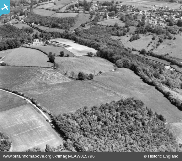
EAW015796 ENGLAND (1948). Steepways and the surrounding countryside, Quarhouse, 1948. This image has been produced from a print.
© Copyright OpenStreetMap contributors and licensed by the OpenStreetMap Foundation. 2024. Cartography is licensed as CC BY-SA.
Nearby Images (7)
Details
| Title | [EAW015796] Steepways and the surrounding countryside, Quarhouse, 1948. This image has been produced from a print. |
| Reference | EAW015796 |
| Date | 18-May-1948 |
| Link | |
| Place name | QUARHOUSE |
| Parish | BRIMSCOMBE AND THRUPP |
| District | |
| Country | ENGLAND |
| Easting / Northing | 387523, 203093 |
| Longitude / Latitude | -2.1806629998942, 51.725959757673 |
| National Grid Reference | SO875031 |
Pins
Be the first to add a comment to this image!


![[EAW015796] Steepways and the surrounding countryside, Quarhouse, 1948. This image has been produced from a print.](http://britainfromabove.org.uk/sites/all/libraries/aerofilms-images/public/100x100/EAW/015/EAW015796.jpg)
![[EAW015794] Steepways Farm and the surrounding countryside, Quarhouse, 1948. This image has been produced from a print.](http://britainfromabove.org.uk/sites/all/libraries/aerofilms-images/public/100x100/EAW/015/EAW015794.jpg)
![[EPW058871] Stringer's Wood and Toadsmoor Valley, Quarhouse, 1938](http://britainfromabove.org.uk/sites/all/libraries/aerofilms-images/public/100x100/EPW/058/EPW058871.jpg)
![[EPW059713] Steepways, Brimscombe, 1938](http://britainfromabove.org.uk/sites/all/libraries/aerofilms-images/public/100x100/EPW/059/EPW059713.jpg)
![[EPW058870] Stringer's Wood and Toadsmoor Valley, Quarhouse, 1938](http://britainfromabove.org.uk/sites/all/libraries/aerofilms-images/public/100x100/EPW/058/EPW058870.jpg)
![[EPW059711] Steepways, Brimscombe, 1938](http://britainfromabove.org.uk/sites/all/libraries/aerofilms-images/public/100x100/EPW/059/EPW059711.jpg)
![[EPW058873] Steepways, Quarhouse, 1938](http://britainfromabove.org.uk/sites/all/libraries/aerofilms-images/public/100x100/EPW/058/EPW058873.jpg)