
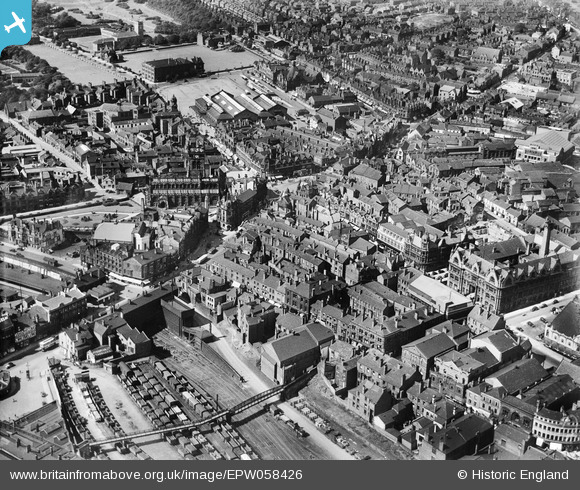
EPW058426 ENGLAND (1938). The town centre, Wigan, 1938
© Copyright OpenStreetMap contributors and licensed by the OpenStreetMap Foundation. 2026. Cartography is licensed as CC BY-SA.
Nearby Images (7)
EPW058426

EPW058428

EPW005024

EPW005028

EPW058427

EPW005026

EPW005027

Details
| Title | [EPW058426] The town centre, Wigan, 1938 |
| Reference | EPW058426 |
| Date | 26-July-1938 |
| Link | |
| Place name | WIGAN |
| Parish | |
| District | |
| Country | ENGLAND |
| Easting / Northing | 358235, 405618 |
| Longitude / Latitude | -2.6303673917765, 53.545293377398 |
| National Grid Reference | SD582056 |
