
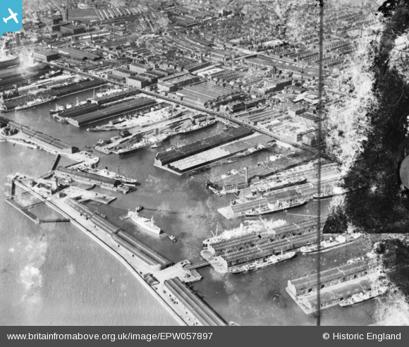
EPW057897 ENGLAND (1938). Canada Dock, Sandhills, 1938. This image has been produced from a damaged copy-negative.
© Copyright OpenStreetMap contributors and licensed by the OpenStreetMap Foundation. 2026. Cartography is licensed as CC BY-SA.
Nearby Images (4)
EPW057897

EPW018892

EPW003059

EPW051519

Details
| Title | [EPW057897] Canada Dock, Sandhills, 1938. This image has been produced from a damaged copy-negative. |
| Reference | EPW057897 |
| Date | July-1938 |
| Link | |
| Place name | SANDHILLS |
| Parish | |
| District | |
| Country | ENGLAND |
| Easting / Northing | 333479, 393882 |
| Longitude / Latitude | -3.0014750696384, 53.437256283474 |
| National Grid Reference | SJ335939 |
Pins
Be the first to add a comment to this image!