
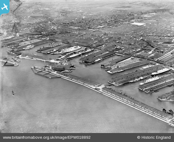
EPW018892 ENGLAND (1927). Canada and Brocklebank Docks, Sandhills, 1927
© Copyright OpenStreetMap contributors and licensed by the OpenStreetMap Foundation. 2026. Cartography is licensed as CC BY-SA.
Nearby Images (6)
EPW018892

EPW057897

EPW003059

EPW051519

EPW018902

EAW023371

Details
| Title | [EPW018892] Canada and Brocklebank Docks, Sandhills, 1927 |
| Reference | EPW018892 |
| Date | 17-July-1927 |
| Link | |
| Place name | SANDHILLS |
| Parish | |
| District | |
| Country | ENGLAND |
| Easting / Northing | 333406, 393858 |
| Longitude / Latitude | -3.0025688238018, 53.437031349508 |
| National Grid Reference | SJ334939 |
Pins
Be the first to add a comment to this image!