
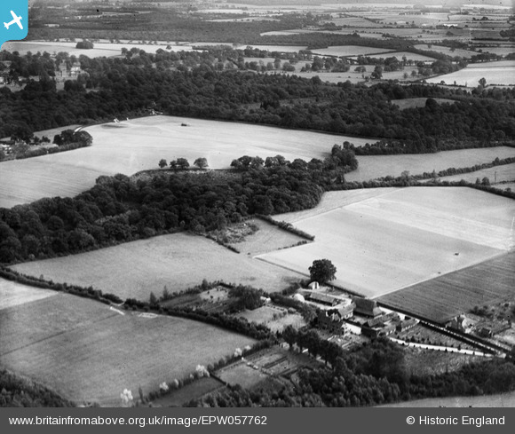
EPW057762 ENGLAND (1938). Peat Gully Copse and Hillend Farm, Sherborne St John, 1938
© Copyright OpenStreetMap contributors and licensed by the OpenStreetMap Foundation. 2026. Cartography is licensed as CC BY-SA.
Nearby Images (5)
EPW057762

EPW057761

EPW057760

EPW057765

EPW057759

Details
| Title | [EPW057762] Peat Gully Copse and Hillend Farm, Sherborne St John, 1938 |
| Reference | EPW057762 |
| Date | 26-June-1938 |
| Link | |
| Place name | SHERBORNE ST JOHN |
| Parish | SHERBORNE ST. JOHN |
| District | |
| Country | ENGLAND |
| Easting / Northing | 462583, 157686 |
| Longitude / Latitude | -1.1019428681624, 51.314334363144 |
| National Grid Reference | SU626577 |
Pins

totoro |
Thursday 7th of November 2013 07:02:19 PM |