
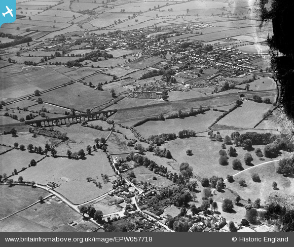
EPW057718 ENGLAND (1938). The Brackley Viaduct and the town, Brackley, 1938. This image has been produced from a damaged negative.
© Copyright OpenStreetMap contributors and licensed by the OpenStreetMap Foundation. 2026. Cartography is licensed as CC BY-SA.
Nearby Images (2)
EPW057718

EPW057716

Details
| Title | [EPW057718] The Brackley Viaduct and the town, Brackley, 1938. This image has been produced from a damaged negative. |
| Reference | EPW057718 |
| Date | 21-June-1938 |
| Link | |
| Place name | BRACKLEY |
| Parish | BRACKLEY |
| District | |
| Country | ENGLAND |
| Easting / Northing | 459449, 237381 |
| Longitude / Latitude | -1.1333401802005, 52.03122647509 |
| National Grid Reference | SP594374 |
Pins

Thermos |
Monday 28th of October 2013 09:03:45 AM | |

MB |
Friday 21st of June 2013 07:10:52 PM | |
Try London (Marylebone) to Manchester via Rugby, Nottingham and Sheffield. |
John Wass |
Wednesday 13th of May 2015 09:26:17 PM |
|
MB |
Friday 21st of June 2013 07:06:27 PM | |
|
MB |
Friday 21st of June 2013 07:06:02 PM | |
|
MB |
Friday 21st of June 2013 07:05:29 PM | |
|
MB |
Friday 21st of June 2013 07:03:22 PM | |
|
MB |
Friday 21st of June 2013 07:02:17 PM | |
|
MB |
Friday 21st of June 2013 07:01:56 PM |
User Comment Contributions
More on the viaduct here: www.forgottenrelics.co.uk/bridges/brackley.html It was demolished in the autumn of 1978, with some difficulty. Brackley people had wanted it retained. The rubble went as hardcore |
MB |
Friday 21st of June 2013 06:58:54 PM |