
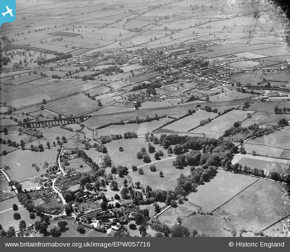
EPW057716 ENGLAND (1938). The village of Turweston, the Brackley Viaduct and the town, Brackley, 1938. This image has been produced from a damaged negative.
© Copyright OpenStreetMap contributors and licensed by the OpenStreetMap Foundation. 2026. Cartography is licensed as CC BY-SA.
Nearby Images (2)
EPW057716

EPW057718

Details
| Title | [EPW057716] The village of Turweston, the Brackley Viaduct and the town, Brackley, 1938. This image has been produced from a damaged negative. |
| Reference | EPW057716 |
| Date | 21-June-1938 |
| Link | |
| Place name | BRACKLEY |
| Parish | BRACKLEY |
| District | |
| Country | ENGLAND |
| Easting / Northing | 459362, 237497 |
| Longitude / Latitude | -1.1345881921263, 52.032278713406 |
| National Grid Reference | SP594375 |
Pins

kansanbrit |
Tuesday 22nd of October 2013 07:48:24 PM | |
|
MB |
Friday 21st of June 2013 07:18:57 PM | |
|
MB |
Friday 21st of June 2013 07:17:30 PM | |
|
MB |
Friday 21st of June 2013 07:16:56 PM | |
|
MB |
Friday 21st of June 2013 07:12:55 PM | |
It was actually built by the Great Central Railway who later came under the control of the LNER before becoming British Railways and subsequently part of the London Midland Region |

Thermos |
Monday 28th of April 2014 09:29:14 PM |
|
MB |
Friday 21st of June 2013 07:12:08 PM |