
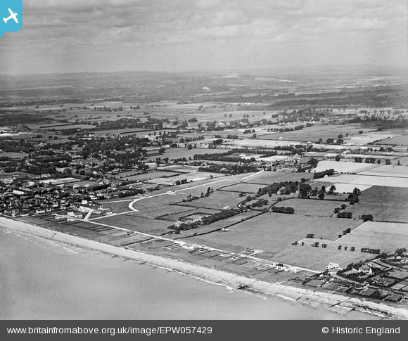
EPW057429 ENGLAND (1938). The site of the residential area off Golden Avenue, Kingston Manor and the surrounding countryside, East Kingston, from the south-east, 1938
© Copyright OpenStreetMap contributors and licensed by the OpenStreetMap Foundation. 2026. Cartography is licensed as CC BY-SA.
Nearby Images (6)
EPW057429

EPW057431

EPW057430

EPW057425

EPW057426

EPW057423

Details
| Title | [EPW057429] The site of the residential area off Golden Avenue, Kingston Manor and the surrounding countryside, East Kingston, from the south-east, 1938 |
| Reference | EPW057429 |
| Date | 3-June-1938 |
| Link | |
| Place name | EAST KINGSTON |
| Parish | KINGSTON |
| District | |
| Country | ENGLAND |
| Easting / Northing | 508098, 101698 |
| Longitude / Latitude | -0.46573986418219, 50.804178693149 |
| National Grid Reference | TQ081017 |
Pins

Bill |
Wednesday 11th of May 2022 10:56:48 AM |