
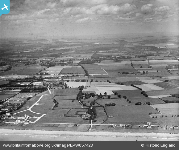
EPW057423 ENGLAND (1938). The site of the residential area off Golden Avenue, Kingston Manor and the surrounding countryside, East Kingston, from the south, 1938. This image has been produced from a damaged negative.
© Copyright OpenStreetMap contributors and licensed by the OpenStreetMap Foundation. 2026. Cartography is licensed as CC BY-SA.
Nearby Images (5)
EPW057423

EPW057425

EPW057426

EPW057429

EPW057431

Details
| Title | [EPW057423] The site of the residential area off Golden Avenue, Kingston Manor and the surrounding countryside, East Kingston, from the south, 1938. This image has been produced from a damaged negative. |
| Reference | EPW057423 |
| Date | 3-June-1938 |
| Link | |
| Place name | EAST KINGSTON |
| Parish | KINGSTON |
| District | |
| Country | ENGLAND |
| Easting / Northing | 508019, 101904 |
| Longitude / Latitude | -0.46680007399296, 50.806045443615 |
| National Grid Reference | TQ080019 |
Pins
Be the first to add a comment to this image!