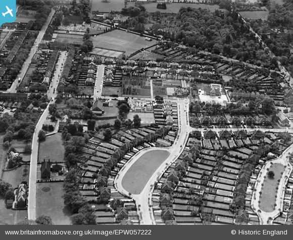
EPW057222 ENGLAND (1938). Shirley Avenue and environs, Shirley, 1938
© Copyright OpenStreetMap contributors and licensed by the OpenStreetMap Foundation. 2026. Cartography is licensed as CC BY-SA.
Nearby Images (9)
Details
| Title | [EPW057222] Shirley Avenue and environs, Shirley, 1938 |
| Reference | EPW057222 |
| Date | 26-May-1938 |
| Link | |
| Place name | SHIRLEY |
| Parish | |
| District | |
| Country | ENGLAND |
| Easting / Northing | 535617, 165733 |
| Longitude / Latitude | -0.051324229874248, 51.373936930302 |
| National Grid Reference | TQ356657 |
Pins

Paul Wendon |
Tuesday 16th of February 2021 09:24:29 PM | |

Paul Wendon |
Tuesday 16th of February 2021 09:24:05 PM | |

vakart |
Saturday 15th of March 2014 11:28:05 PM |


![[EPW057222] Shirley Avenue and environs, Shirley, 1938](http://britainfromabove.org.uk/sites/all/libraries/aerofilms-images/public/100x100/EPW/057/EPW057222.jpg)
![[EPW057221] Shirley Avenue and environs, Shirley, 1938](http://britainfromabove.org.uk/sites/all/libraries/aerofilms-images/public/100x100/EPW/057/EPW057221.jpg)
![[EPW057226] Shirley Avenue, Wickham Road and environs, Shirley, 1938](http://britainfromabove.org.uk/sites/all/libraries/aerofilms-images/public/100x100/EPW/057/EPW057226.jpg)
![[EPW057220] Shirley Avenue, Barnfield Avenue and environs, Shirley, 1938](http://britainfromabove.org.uk/sites/all/libraries/aerofilms-images/public/100x100/EPW/057/EPW057220.jpg)
![[EPW057224] Shirley Avenue, Wickham Road and environs, Shirley, 1938](http://britainfromabove.org.uk/sites/all/libraries/aerofilms-images/public/100x100/EPW/057/EPW057224.jpg)
![[EPW057225] Wickham Road and environs, Shirley, 1938](http://britainfromabove.org.uk/sites/all/libraries/aerofilms-images/public/100x100/EPW/057/EPW057225.jpg)
![[EPW057223] Eldon Avenue, Barnfield Avenue and environs, Shirley, 1938](http://britainfromabove.org.uk/sites/all/libraries/aerofilms-images/public/100x100/EPW/057/EPW057223.jpg)
![[EPW057218] Shirley Church Road, Wickham Road and environs, Shirley, 1938](http://britainfromabove.org.uk/sites/all/libraries/aerofilms-images/public/100x100/EPW/057/EPW057218.jpg)
![[EPW057219] Shirley Church Road, Wickham Road and environs, Shirley, 1938](http://britainfromabove.org.uk/sites/all/libraries/aerofilms-images/public/100x100/EPW/057/EPW057219.jpg)