
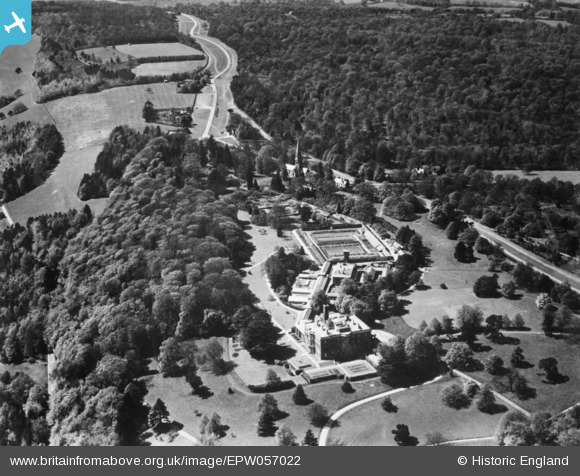
EPW057022 ENGLAND (1938). Denbies, Ranmore Common, 1938. This image has been produced from a copy-negative.
© Copyright OpenStreetMap contributors and licensed by the OpenStreetMap Foundation. 2026. Cartography is licensed as CC BY-SA.
Nearby Images (3)
EPW057022

EPW025266

EPW025267

Details
| Title | [EPW057022] Denbies, Ranmore Common, 1938. This image has been produced from a copy-negative. |
| Reference | EPW057022 |
| Date | 5-May-1938 |
| Link | |
| Place name | RANMORE COMMON |
| Parish | WOTTON |
| District | |
| Country | ENGLAND |
| Easting / Northing | 514755, 150424 |
| Longitude / Latitude | -0.35587063489279, 51.240924026932 |
| National Grid Reference | TQ148504 |
Pins
Be the first to add a comment to this image!