
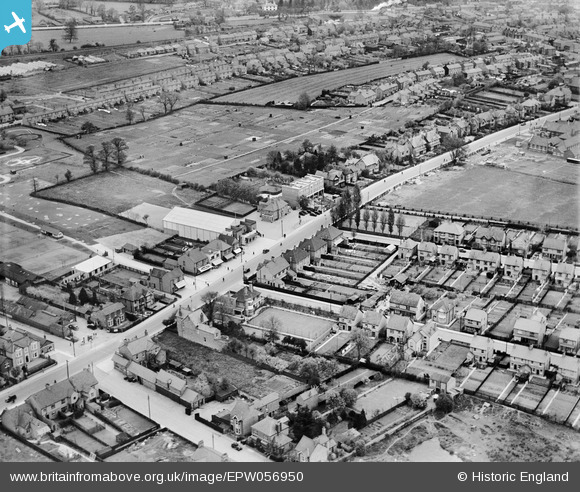
EPW056950 ENGLAND (1938). Bletchley Road (now Queensway), Fenny Stratford, 1938
© Copyright OpenStreetMap contributors and licensed by the OpenStreetMap Foundation. 2026. Cartography is licensed as CC BY-SA.
Nearby Images (2)
EPW056950
, Fenny Stratford, 1938")
EPW022467

Details
| Title | [EPW056950] Bletchley Road (now Queensway), Fenny Stratford, 1938 |
| Reference | EPW056950 |
| Date | 26-April-1938 |
| Link | |
| Place name | FENNY STRATFORD |
| Parish | BLETCHLEY AND FENNY STRATFORD |
| District | |
| Country | ENGLAND |
| Easting / Northing | 487548, 233782 |
| Longitude / Latitude | -0.72471963844348, 51.995148891285 |
| National Grid Reference | SP875338 |
Pins
Be the first to add a comment to this image!