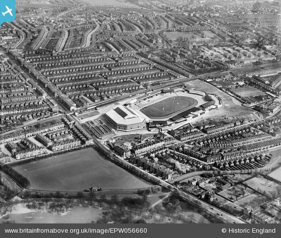
EPW056660 ENGLAND (1938). Harringay Greyhound and Motor Cycle Stadium, Harringay, 1938
© Copyright OpenStreetMap contributors and licensed by the OpenStreetMap Foundation. 2026. Cartography is licensed as CC BY-SA.
Nearby Images (5)
Details
| Title | [EPW056660] Harringay Greyhound and Motor Cycle Stadium, Harringay, 1938 |
| Reference | EPW056660 |
| Date | 30-March-1938 |
| Link | |
| Place name | HARRINGAY |
| Parish | |
| District | |
| Country | ENGLAND |
| Easting / Northing | 531993, 188126 |
| Longitude / Latitude | -0.094998393019961, 51.576050273298 |
| National Grid Reference | TQ320881 |
Pins

Leslie B |
Thursday 24th of March 2022 09:07:07 PM | |

Alarney |
Sunday 28th of March 2021 01:57:18 PM | |

Class31 |
Wednesday 17th of December 2014 12:24:41 PM | |

Class31 |
Wednesday 17th of December 2014 12:23:40 PM | |

Class31 |
Wednesday 17th of December 2014 12:21:49 PM | |

Class31 |
Wednesday 17th of December 2014 12:20:47 PM | |

Class31 |
Wednesday 17th of December 2014 12:18:34 PM | |

Class31 |
Wednesday 17th of December 2014 11:35:48 AM |


![[EPW056660] Harringay Greyhound and Motor Cycle Stadium, Harringay, 1938](http://britainfromabove.org.uk/sites/all/libraries/aerofilms-images/public/100x100/EPW/056/EPW056660.jpg)
![[EPW056659] Harringay Greyhound and Motor Cycle Stadium, Harringay, 1938](http://britainfromabove.org.uk/sites/all/libraries/aerofilms-images/public/100x100/EPW/056/EPW056659.jpg)
![[EAW008756] The Harringay Arena and Stadium, Harringay, 1947](http://britainfromabove.org.uk/sites/all/libraries/aerofilms-images/public/100x100/EAW/008/EAW008756.jpg)
![[EAW008755] The Harringay Arena and Stadium, Harringay, 1947. This image has been produced from a damaged negative.](http://britainfromabove.org.uk/sites/all/libraries/aerofilms-images/public/100x100/EAW/008/EAW008755.jpg)
![[EPW031662] Harringay Stadium and Green Lanes, Harringay, from the north-west, 1930](http://britainfromabove.org.uk/sites/all/libraries/aerofilms-images/public/100x100/EPW/031/EPW031662.jpg)