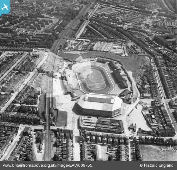
EAW008755 ENGLAND (1947). The Harringay Arena and Stadium, Harringay, 1947. This image has been produced from a damaged negative.
© Copyright OpenStreetMap contributors and licensed by the OpenStreetMap Foundation. 2026. Cartography is licensed as CC BY-SA.
Nearby Images (8)
Details
| Title | [EAW008755] The Harringay Arena and Stadium, Harringay, 1947. This image has been produced from a damaged negative. |
| Reference | EAW008755 |
| Date | 8-August-1947 |
| Link | |
| Place name | HARRINGAY |
| Parish | |
| District | |
| Country | ENGLAND |
| Easting / Northing | 532058, 188158 |
| Longitude / Latitude | -0.094048799471398, 51.576322644261 |
| National Grid Reference | TQ321882 |
Pins
Be the first to add a comment to this image!


![[EAW008755] The Harringay Arena and Stadium, Harringay, 1947. This image has been produced from a damaged negative.](http://britainfromabove.org.uk/sites/all/libraries/aerofilms-images/public/100x100/EAW/008/EAW008755.jpg)
![[EAW008756] The Harringay Arena and Stadium, Harringay, 1947](http://britainfromabove.org.uk/sites/all/libraries/aerofilms-images/public/100x100/EAW/008/EAW008756.jpg)
![[EPW056659] Harringay Greyhound and Motor Cycle Stadium, Harringay, 1938](http://britainfromabove.org.uk/sites/all/libraries/aerofilms-images/public/100x100/EPW/056/EPW056659.jpg)
![[EPW056660] Harringay Greyhound and Motor Cycle Stadium, Harringay, 1938](http://britainfromabove.org.uk/sites/all/libraries/aerofilms-images/public/100x100/EPW/056/EPW056660.jpg)
![[EPW044028] The British Woodcraft Ltd Piano and Joinery Works alongside Hermitage Road, Harringay, 1934](http://britainfromabove.org.uk/sites/all/libraries/aerofilms-images/public/100x100/EPW/044/EPW044028.jpg)
![[EPW044029] The British Woodcraft Ltd Piano and Joinery Works alongside Hermitage Road, Harringay, 1934](http://britainfromabove.org.uk/sites/all/libraries/aerofilms-images/public/100x100/EPW/044/EPW044029.jpg)
![[EPW044095] The British Woodcraft Ltd Piano and Joinery Works and Harringay Stadium, Harringay, 1934](http://britainfromabove.org.uk/sites/all/libraries/aerofilms-images/public/100x100/EPW/044/EPW044095.jpg)
![[EPW031662] Harringay Stadium and Green Lanes, Harringay, from the north-west, 1930](http://britainfromabove.org.uk/sites/all/libraries/aerofilms-images/public/100x100/EPW/031/EPW031662.jpg)