
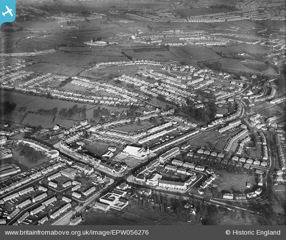
EPW056276 ENGLAND (1938). Greenford Road, Oldfield Lane and environs, Greenford, from the south-east, 1938
© Copyright OpenStreetMap contributors and licensed by the OpenStreetMap Foundation. 2026. Cartography is licensed as CC BY-SA.
Nearby Images (9)
EPW056276

EPW056273

EPR000617

EPW056284

EPW056277

EPW020328

EPW056279

EPW056274

EPW056286

Details
| Title | [EPW056276] Greenford Road, Oldfield Lane and environs, Greenford, from the south-east, 1938 |
| Reference | EPW056276 |
| Date | 17-January-1938 |
| Link | |
| Place name | GREENFORD |
| Parish | |
| District | |
| Country | ENGLAND |
| Easting / Northing | 514447, 182257 |
| Longitude / Latitude | -0.35002098963775, 51.527131992657 |
| National Grid Reference | TQ144823 |
Pins

The Laird |
Thursday 28th of February 2019 02:18:38 PM | |
|
The Laird |
Thursday 28th of February 2019 02:02:14 PM | |
|
The Laird |
Thursday 28th of February 2019 02:01:23 PM | |
|
The Laird |
Thursday 28th of February 2019 01:59:13 PM | |
|
The Laird |
Thursday 28th of February 2019 01:48:59 PM | |
|
The Laird |
Thursday 28th of February 2019 01:41:46 PM | |
|
The Laird |
Thursday 28th of February 2019 01:34:46 PM | |
|
GaryW |
Wednesday 12th of August 2015 06:33:15 PM | |
|
GaryW |
Wednesday 12th of August 2015 06:32:20 PM |