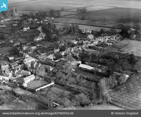
EPW056146 ENGLAND (1937). The Dairy and the village, Fenstanton, 1937
© Copyright OpenStreetMap contributors and licensed by the OpenStreetMap Foundation. 2025. Cartography is licensed as CC BY-SA.
Nearby Images (6)
Details
| Title | [EPW056146] The Dairy and the village, Fenstanton, 1937 |
| Reference | EPW056146 |
| Date | 18-November-1937 |
| Link | |
| Place name | FENSTANTON |
| Parish | FENSTANTON |
| District | |
| Country | ENGLAND |
| Easting / Northing | 531633, 268354 |
| Longitude / Latitude | -0.069481307457104, 52.297128300123 |
| National Grid Reference | TL316684 |
Pins
 EastMarple1 |
Friday 26th of September 2014 11:16:50 PM |


![[EPW056146] The Dairy and the village, Fenstanton, 1937](http://britainfromabove.org.uk/sites/all/libraries/aerofilms-images/public/100x100/EPW/056/EPW056146.jpg)
![[EPW056143] The Dairy and the village, Fenstanton, 1937](http://britainfromabove.org.uk/sites/all/libraries/aerofilms-images/public/100x100/EPW/056/EPW056143.jpg)
![[EPW056142] The Dairy and the village, Fenstanton, 1937](http://britainfromabove.org.uk/sites/all/libraries/aerofilms-images/public/100x100/EPW/056/EPW056142.jpg)
![[EPW056141] The Dairy and environs, Fenstanton, 1937](http://britainfromabove.org.uk/sites/all/libraries/aerofilms-images/public/100x100/EPW/056/EPW056141.jpg)
![[EPW056144] The Dairy and the village, Fenstanton, 1937](http://britainfromabove.org.uk/sites/all/libraries/aerofilms-images/public/100x100/EPW/056/EPW056144.jpg)
![[EPW056145] The Dairy and The Gables, Fenstanton, 1937](http://britainfromabove.org.uk/sites/all/libraries/aerofilms-images/public/100x100/EPW/056/EPW056145.jpg)