
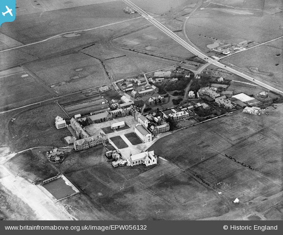
EPW056132 ENGLAND (1937). Rossall School, Fleetwood, 1937
© Copyright OpenStreetMap contributors and licensed by the OpenStreetMap Foundation. 2026. Cartography is licensed as CC BY-SA.
Nearby Images (12)
EPW056132

EPW056128

EPW056124

EPW056129

EPW056135

EPW056134

EPW056133

EPW056130

EPW056131

EPW056126

EPW056125

EPW056127

Details
| Title | [EPW056132] Rossall School, Fleetwood, 1937 |
| Reference | EPW056132 |
| Date | November-1937 |
| Link | |
| Place name | FLEETWOOD |
| Parish | FLEETWOOD |
| District | |
| Country | ENGLAND |
| Easting / Northing | 331507, 444934 |
| Longitude / Latitude | -3.0424223166684, 53.895845740588 |
| National Grid Reference | SD315449 |
Pins
Be the first to add a comment to this image!