
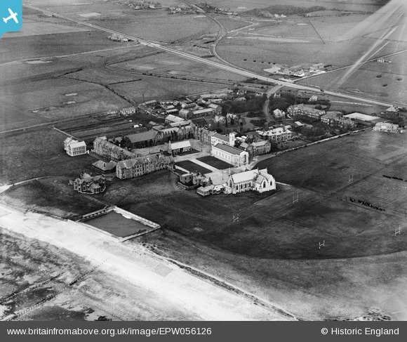
EPW056126 ENGLAND (1937). Rossall School, Fleetwood, 1937. This image has been affected by flare.
© Copyright OpenStreetMap contributors and licensed by the OpenStreetMap Foundation. 2026. Cartography is licensed as CC BY-SA.
Nearby Images (12)
EPW056126

EPW056130

EPW056133

EPW056134

EPW056128

EPW056131

EPW056132

EPW056124

EPW056135

EPW056129

EPW056127

EPW056125

Details
| Title | [EPW056126] Rossall School, Fleetwood, 1937. This image has been affected by flare. |
| Reference | EPW056126 |
| Date | November-1937 |
| Link | |
| Place name | FLEETWOOD |
| Parish | FLEETWOOD |
| District | |
| Country | ENGLAND |
| Easting / Northing | 331440, 444850 |
| Longitude / Latitude | -3.0434230211786, 53.895081944393 |
| National Grid Reference | SD314449 |
Pins
Be the first to add a comment to this image!