
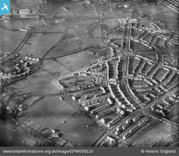
EPW056110 ENGLAND (1937). A residential area under construction at Bellingham, Catford, 1937
© Copyright OpenStreetMap contributors and licensed by the OpenStreetMap Foundation. 2026. Cartography is licensed as CC BY-SA.
Nearby Images (8)
EPW056110

EPW056116

EPW056122

EPW056115

EPW056123

EPW056121

EPW056117

EPW056107

Details
| Title | [EPW056110] A residential area under construction at Bellingham, Catford, 1937 |
| Reference | EPW056110 |
| Date | November-1937 |
| Link | |
| Place name | CATFORD |
| Parish | |
| District | |
| Country | ENGLAND |
| Easting / Northing | 537548, 171421 |
| Longitude / Latitude | -0.021390166891541, 51.42459211507 |
| National Grid Reference | TQ375714 |
Pins
Be the first to add a comment to this image!