
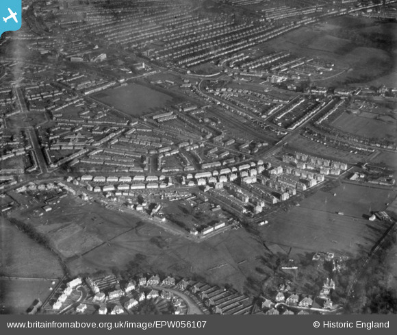
EPW056107 ENGLAND (1937). A residential area under construction at Bellingham, Catford, 1937. This image has been produced from a print.
© Copyright OpenStreetMap contributors and licensed by the OpenStreetMap Foundation. 2026. Cartography is licensed as CC BY-SA.
Nearby Images (8)
EPW056107

EPW056117

EPW056123

EPW056121

EPW056115

EPW056122

EPW056116

EPW056110

Details
| Title | [EPW056107] A residential area under construction at Bellingham, Catford, 1937. This image has been produced from a print. |
| Reference | EPW056107 |
| Date | November-1937 |
| Link | |
| Place name | CATFORD |
| Parish | |
| District | |
| Country | ENGLAND |
| Easting / Northing | 537726, 171595 |
| Longitude / Latitude | -0.018763656163294, 51.426112660764 |
| National Grid Reference | TQ377716 |
Pins

Naomi |
Monday 29th of March 2021 01:09:20 PM |