
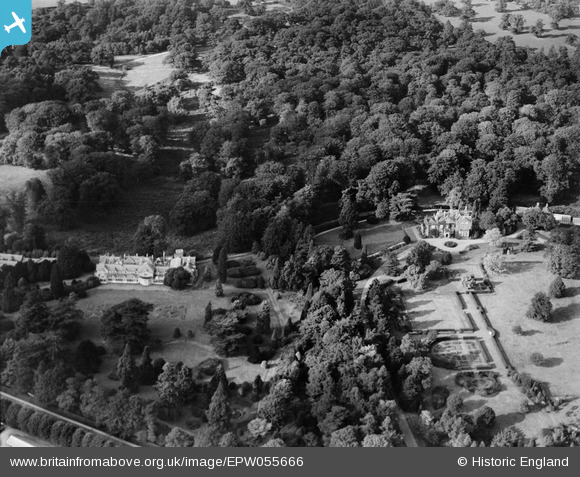
EPW055666 ENGLAND (1937). The Dell and Park Place, Englefield Green, 1937
© Copyright OpenStreetMap contributors and licensed by the OpenStreetMap Foundation. 2024. Cartography is licensed as CC BY-SA.
Nearby Images (5)
EPW055666

EPW055663

EPW055667

EPW055665

EPW055664

Details
| Title | [EPW055666] The Dell and Park Place, Englefield Green, 1937 |
| Reference | EPW055666 |
| Date | 30-September-1937 |
| Link | |
| Place name | ENGLEFIELD GREEN |
| Parish | |
| District | |
| Country | ENGLAND |
| Easting / Northing | 498120, 172344 |
| Longitude / Latitude | -0.58807872344227, 51.441090030233 |
| National Grid Reference | SU981723 |
Pins
Be the first to add a comment to this image!