
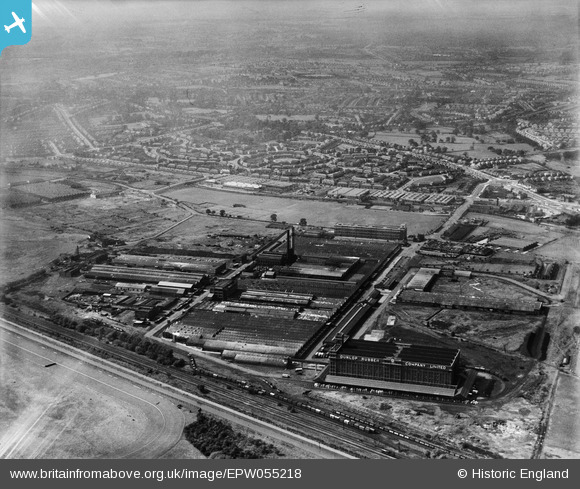
EPW055218 ENGLAND (1937). The Fort Dunlop Rubber Works, Bromford, from the south-east, 1937
© Copyright OpenStreetMap contributors and licensed by the OpenStreetMap Foundation. 2026. Cartography is licensed as CC BY-SA.
Nearby Images (17)
EPW055218

EPW055217

EPW055215

EPW055216

EPW055213

EPW026942

EPW055214

EPW022583

EPW026932

EPW018353

EPW025791

EPW055212

EPW055211

EPW026939

EPW022582

EPW026937

EPW026934

Details
| Title | [EPW055218] The Fort Dunlop Rubber Works, Bromford, from the south-east, 1937 |
| Reference | EPW055218 |
| Date | 4-September-1937 |
| Link | |
| Place name | BROMFORD |
| Parish | |
| District | |
| Country | ENGLAND |
| Easting / Northing | 412729, 290246 |
| Longitude / Latitude | -1.8124274325396, 52.509591450187 |
| National Grid Reference | SP127902 |
Pins
Be the first to add a comment to this image!