
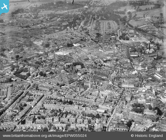
EPW055024 ENGLAND (1937). The city centre, Derby, from the south-east, 1937
© Copyright OpenStreetMap contributors and licensed by the OpenStreetMap Foundation. 2026. Cartography is licensed as CC BY-SA.
Nearby Images (6)
EPW055024

EPW005816

EAW004662

EPW005815

EAW004664

EAW004655

Details
| Title | [EPW055024] The city centre, Derby, from the south-east, 1937 |
| Reference | EPW055024 |
| Date | August-1937 |
| Link | |
| Place name | DERBY |
| Parish | |
| District | |
| Country | ENGLAND |
| Easting / Northing | 435052, 336043 |
| Longitude / Latitude | -1.4786031078578, 52.92034091601 |
| National Grid Reference | SK351360 |
Pins

aremla |
Friday 15th of January 2016 07:54:49 PM | |
|
Maitland |
Sunday 19th of January 2014 11:50:51 AM | |
|
Wak |
Saturday 28th of December 2013 07:54:35 PM | |
|
Wak |
Saturday 28th of December 2013 07:54:06 PM | |
|
Wak |
Saturday 28th of December 2013 07:53:32 PM | |
|
Triggy |
Wednesday 7th of August 2013 09:54:14 PM | |
|
Triggy |
Wednesday 7th of August 2013 09:49:31 PM |