
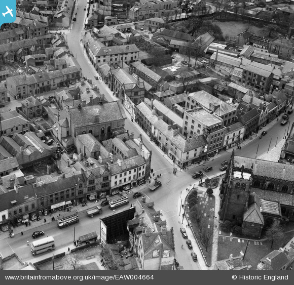
EAW004664 ENGLAND (1947). The junction of Curzon Street and Wardwick, Derby, 1947
© Copyright OpenStreetMap contributors and licensed by the OpenStreetMap Foundation. 2026. Cartography is licensed as CC BY-SA.
Nearby Images (6)
EAW004664

EPW005816

EAW004662

EPW055024

EAW044086

EAW004663

Details
| Title | [EAW004664] The junction of Curzon Street and Wardwick, Derby, 1947 |
| Reference | EAW004664 |
| Date | 22-April-1947 |
| Link | |
| Place name | DERBY |
| Parish | |
| District | |
| Country | ENGLAND |
| Easting / Northing | 434951, 336268 |
| Longitude / Latitude | -1.4800811812326, 52.922370241124 |
| National Grid Reference | SK350363 |
Pins

Triggy |
Tuesday 2nd of June 2015 06:49:13 PM | |
|
Maitland |
Monday 1st of June 2015 08:38:22 PM | |

melgibbs |
Saturday 15th of February 2014 07:06:12 PM | |
|
melgibbs |
Saturday 15th of February 2014 07:03:17 PM | |
|
melgibbs |
Saturday 15th of February 2014 07:02:51 PM | |
|
melgibbs |
Saturday 15th of February 2014 07:01:34 PM | |
|
melgibbs |
Saturday 15th of February 2014 06:59:41 PM | |
|
melgibbs |
Saturday 15th of February 2014 06:55:51 PM |