
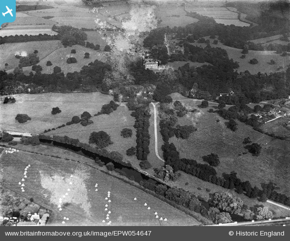
EPW054647 ENGLAND (1937). Croxdale Hall, Sunderland Bridge, from the west, 1937. This image has been produced from a damaged negative.
© Copyright OpenStreetMap contributors and licensed by the OpenStreetMap Foundation. 2026. Cartography is licensed as CC BY-SA.
Nearby Images (2)
EPW054647

EPW054646

Details
| Title | [EPW054647] Croxdale Hall, Sunderland Bridge, from the west, 1937. This image has been produced from a damaged negative. |
| Reference | EPW054647 |
| Date | 30-July-1937 |
| Link | |
| Place name | SUNDERLAND BRIDGE |
| Parish | CROXDALE AND HETT |
| District | |
| Country | ENGLAND |
| Easting / Northing | 426859, 537942 |
| Longitude / Latitude | -1.5828183474794, 54.735631099487 |
| National Grid Reference | NZ269379 |
Pins
Be the first to add a comment to this image!