
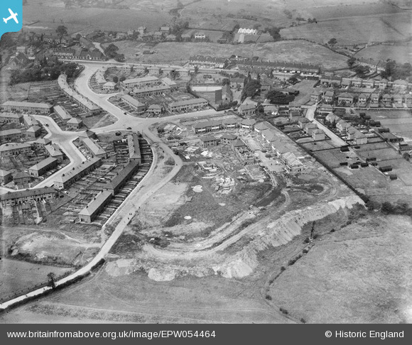
EPW054464 ENGLAND (1937). The residential area at Harewood Road under construction, Irlam, 1937
© Copyright OpenStreetMap contributors and licensed by the OpenStreetMap Foundation. 2026. Cartography is licensed as CC BY-SA.
Nearby Images (12)
EPW054464

EPW054461

EPW054469

EPW054463

EPW054459

EPW054460

EPW054458

EPW054465

EPW054462

EPW054468

EPW054466

EPW054467

Details
| Title | [EPW054464] The residential area at Harewood Road under construction, Irlam, 1937 |
| Reference | EPW054464 |
| Date | 30-July-1937 |
| Link | |
| Place name | IRLAM |
| Parish | |
| District | |
| Country | ENGLAND |
| Easting / Northing | 372580, 394694 |
| Longitude / Latitude | -2.4129081779771, 53.448040167713 |
| National Grid Reference | SJ726947 |
Pins
Be the first to add a comment to this image!