
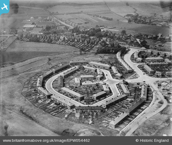
EPW054462 ENGLAND (1937). The residential area at Eldon Road and Etherley Close, Irlam, 1937. This image has been produced from a damaged negative.
© Copyright OpenStreetMap contributors and licensed by the OpenStreetMap Foundation. 2026. Cartography is licensed as CC BY-SA.
Nearby Images (12)
EPW054462

EPW054458

EPW054460

EPW054459

EPW054465

EPW054468

EPW054467

EPW054466

EPW054461

EPW054463

EPW054464

EPW054469

Details
| Title | [EPW054462] The residential area at Eldon Road and Etherley Close, Irlam, 1937. This image has been produced from a damaged negative. |
| Reference | EPW054462 |
| Date | 30-July-1937 |
| Link | |
| Place name | IRLAM |
| Parish | |
| District | |
| Country | ENGLAND |
| Easting / Northing | 372427, 394600 |
| Longitude / Latitude | -2.4152038450946, 53.447187188505 |
| National Grid Reference | SJ724946 |
Pins
Be the first to add a comment to this image!