
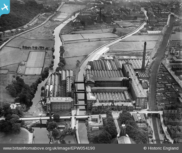
EPW054190 ENGLAND (1937). Salt's Mill, Saltaire, 1937
© Copyright OpenStreetMap contributors and licensed by the OpenStreetMap Foundation. 2026. Cartography is licensed as CC BY-SA.
Nearby Images (8)
EPW054190

EPW054205

EPW054206

EPW054203

EPW054196

EPW054204

EPW024515

EPW054197

Details
| Title | [EPW054190] Salt's Mill, Saltaire, 1937 |
| Reference | EPW054190 |
| Date | 13-July-1937 |
| Link | |
| Place name | SALTAIRE |
| Parish | |
| District | |
| Country | ENGLAND |
| Easting / Northing | 414134, 438098 |
| Longitude / Latitude | -1.7851852949432, 53.838730573463 |
| National Grid Reference | SE141381 |
Pins
Be the first to add a comment to this image!