
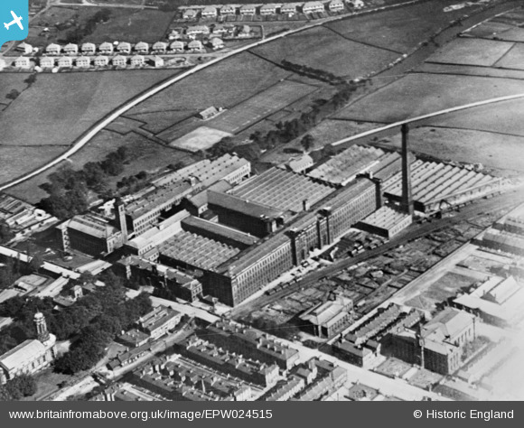
EPW024515 ENGLAND (1928). The Saltaire Mills, Saltaire, 1928. This image has been produced from a copy-negative.
© Copyright OpenStreetMap contributors and licensed by the OpenStreetMap Foundation. 2026. Cartography is licensed as CC BY-SA.
Nearby Images (10)
EPW024515

EPW054206

EPW054203

EPW054190

EPW054205

EPW054204

EPW054196

EPW054197

EPW054192

EPW054191

Details
| Title | [EPW024515] The Saltaire Mills, Saltaire, 1928. This image has been produced from a copy-negative. |
| Reference | EPW024515 |
| Date | September-1928 |
| Link | |
| Place name | SALTAIRE |
| Parish | |
| District | |
| Country | ENGLAND |
| Easting / Northing | 414075, 438085 |
| Longitude / Latitude | -1.7860825913789, 53.838615319898 |
| National Grid Reference | SE141381 |
Pins
Be the first to add a comment to this image!