
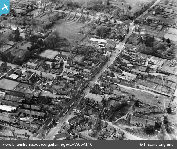
EPW054146 ENGLAND (1937). The High Street, Edenbridge, 1937
© Copyright OpenStreetMap contributors and licensed by the OpenStreetMap Foundation. 2026. Cartography is licensed as CC BY-SA.
Nearby Images (6)
EPW054146

EPW054145

EPW026259

EPW026263

EPW026262

EPW026260

Details
| Title | [EPW054146] The High Street, Edenbridge, 1937 |
| Reference | EPW054146 |
| Date | 7-July-1937 |
| Link | |
| Place name | EDENBRIDGE |
| Parish | EDENBRIDGE |
| District | |
| Country | ENGLAND |
| Easting / Northing | 544352, 146188 |
| Longitude / Latitude | 0.066203216285, 51.196132874377 |
| National Grid Reference | TQ444462 |
Pins
Be the first to add a comment to this image!