
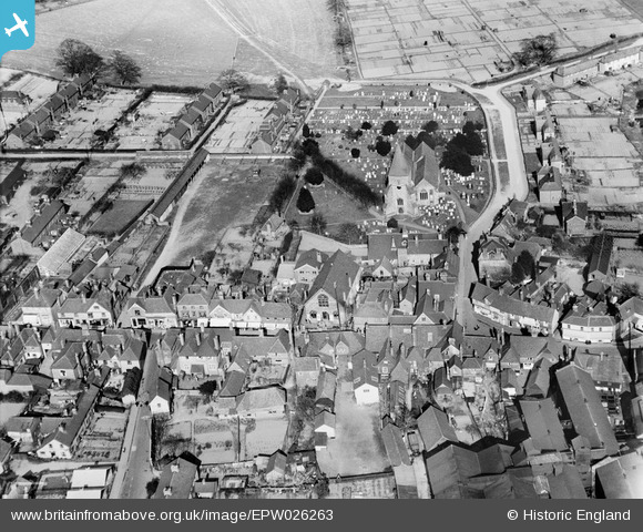
EPW026263 ENGLAND (1929). St Peter and St Paul's Church ad environs, Edenbridge, 1929
© Copyright OpenStreetMap contributors and licensed by the OpenStreetMap Foundation. 2026. Cartography is licensed as CC BY-SA.
Nearby Images (6)
EPW026263

EPW026260

EPW026262

EPW054145

EPW054146

EPW026259

Details
| Title | [EPW026263] St Peter and St Paul's Church ad environs, Edenbridge, 1929 |
| Reference | EPW026263 |
| Date | 25-April-1929 |
| Link | |
| Place name | EDENBRIDGE |
| Parish | EDENBRIDGE |
| District | |
| Country | ENGLAND |
| Easting / Northing | 544436, 146142 |
| Longitude / Latitude | 0.067386214032008, 51.19569823622 |
| National Grid Reference | TQ444461 |
Pins
Be the first to add a comment to this image!