
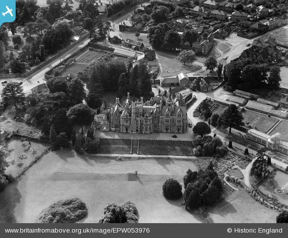
EPW053976 ENGLAND (1937). Stanmore Hall, Stanmore, 1937
© Copyright OpenStreetMap contributors and licensed by the OpenStreetMap Foundation. 2024. Cartography is licensed as CC BY-SA.
Nearby Images (2)
EPW053976

EPR000523

Details
| Title | [EPW053976] Stanmore Hall, Stanmore, 1937 |
| Reference | EPW053976 |
| Date | June-1937 |
| Link | |
| Place name | STANMORE |
| Parish | |
| District | |
| Country | ENGLAND |
| Easting / Northing | 516511, 193049 |
| Longitude / Latitude | -0.31669758842323, 51.623713881164 |
| National Grid Reference | TQ165930 |
