
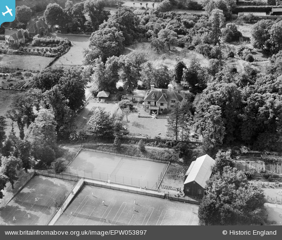
EPW053897 ENGLAND (1937). Dron House and surroundings, Stanmore, 1937
© Copyright OpenStreetMap contributors and licensed by the OpenStreetMap Foundation. 2026. Cartography is licensed as CC BY-SA.
Nearby Images (6)
EPW053897

EPW053896

EPW053898

EPW053894

EPW053895

EPW053977

Details
| Title | [EPW053897] Dron House and surroundings, Stanmore, 1937 |
| Reference | EPW053897 |
| Date | June-1937 |
| Link | |
| Place name | STANMORE |
| Parish | |
| District | |
| Country | ENGLAND |
| Easting / Northing | 516806, 192396 |
| Longitude / Latitude | -0.31265530210649, 51.617783278382 |
| National Grid Reference | TQ168924 |
Pins
Be the first to add a comment to this image!