
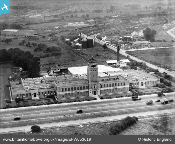
EPW053619 ENGLAND (1937). The Aladdin Building, Greenford, from the south-west, 1937
© Copyright OpenStreetMap contributors and licensed by the OpenStreetMap Foundation. 2026. Cartography is licensed as CC BY-SA.
Nearby Images (23)
EPW053619

EPW038795
, Greenford, 1932")
EPW038796
, Greenford, 1932")
EPW053621

EPW053618

EPW038798
 and Greenford Trotting Track, Greenford, 1932")
EPW053620

EPR000604
, Greenford, 1935")
EPW053622

EPW038794
 and Greenford Trotting Track, Greenford, 1932")
EPW038797
, Greenford, 1932")
EPW038793
, Greenford, 1932")
EPW053625

EPW053623

EPW053617

EPW053624

EPW059347
, Greenford, 1938")
EPR000029
, Greenford, 1934")
EPR000028

EPW061233

EPW034570

EPW059346
 and environs, Greenford, 1938")
EPW034573

Details
| Title | [EPW053619] The Aladdin Building, Greenford, from the south-west, 1937 |
| Reference | EPW053619 |
| Date | 12-June-1937 |
| Link | |
| Place name | GREENFORD |
| Parish | |
| District | |
| Country | ENGLAND |
| Easting / Northing | 513764, 183538 |
| Longitude / Latitude | -0.359449463159, 51.53878464451 |
| National Grid Reference | TQ138835 |
Pins
Be the first to add a comment to this image!
User Comment Contributions
Just five years and already the area is changing from country to a built up urban area. I am very glad the Aladdin Building has protected status. I could see it from my bedroom when I was a kid in the 1950s. The tower itself used to be floodlight with coloured lights at the top. it was quite a spectacle. |

david |
Monday 15th of July 2013 06:13:58 PM |