
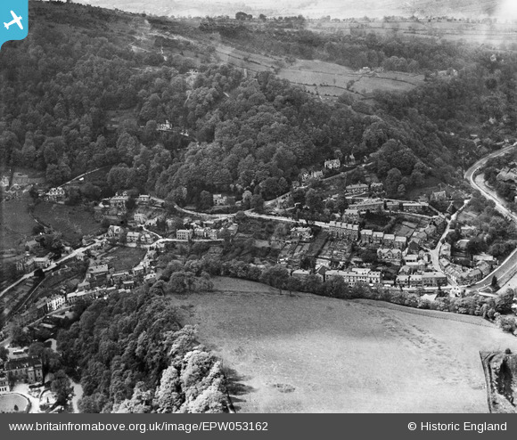
EPW053162 ENGLAND (1937). The village, Matlock Bath, 1937
© Copyright OpenStreetMap contributors and licensed by the OpenStreetMap Foundation. 2025. Cartography is licensed as CC BY-SA.
Nearby Images (2)
EPW053162

EAW006295

Details
| Title | [EPW053162] The village, Matlock Bath, 1937 |
| Reference | EPW053162 |
| Date | 20-May-1937 |
| Link | |
| Place name | MATLOCK BATH |
| Parish | MATLOCK BATH |
| District | |
| Country | ENGLAND |
| Easting / Northing | 429411, 358460 |
| Longitude / Latitude | -1.5604663151183, 53.122206546379 |
| National Grid Reference | SK294585 |
Pins

ClareHerbert |
Saturday 11th of December 2021 06:31:26 AM | |
|
ClareHerbert |
Saturday 11th of December 2021 06:30:29 AM | |
|
ClareHerbert |
Saturday 11th of December 2021 06:29:58 AM | |
|
ClareHerbert |
Saturday 11th of December 2021 06:28:29 AM | |
|
ClareHerbert |
Saturday 11th of December 2021 06:27:42 AM | |
|
ClareHerbert |
Saturday 11th of December 2021 06:26:57 AM | |
|
PooleSider |
Monday 17th of November 2014 12:12:57 PM |