
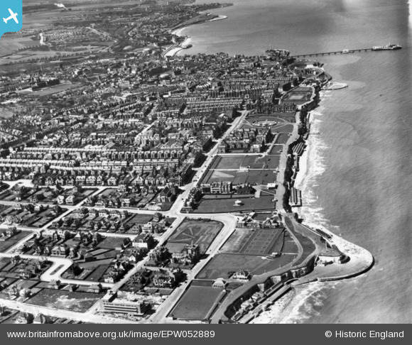
EPW052889 ENGLAND (1937). The town and seafront, Margate, 1937. This image has been produced from a print.
© Copyright OpenStreetMap contributors and licensed by the OpenStreetMap Foundation. 2026. Cartography is licensed as CC BY-SA.
Nearby Images (7)
EPW052889

EPW000637

EPW052888

EPW000329

EPW039393

EPW000618

EPW039392

Details
| Title | [EPW052889] The town and seafront, Margate, 1937. This image has been produced from a print. |
| Reference | EPW052889 |
| Date | 24-April-1937 |
| Link | |
| Place name | MARGATE |
| Parish | |
| District | |
| Country | ENGLAND |
| Easting / Northing | 636793, 171244 |
| Longitude / Latitude | 1.4039774045583, 51.390246536049 |
| National Grid Reference | TR368712 |
Pins
Be the first to add a comment to this image!