
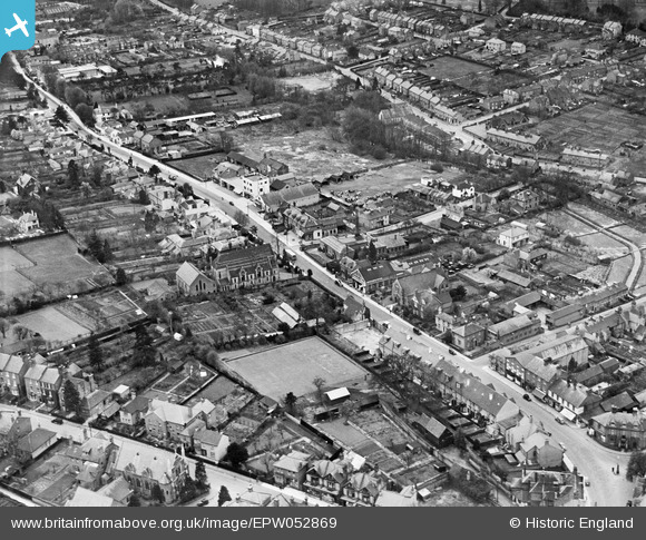
EPW052869 ENGLAND (1937). Marlowes and environs, Hemel Hempstead, 1937
© Copyright OpenStreetMap contributors and licensed by the OpenStreetMap Foundation. 2026. Cartography is licensed as CC BY-SA.
Nearby Images (9)
EPW052869

EAW017250

EAW014884

EPW052868

EPW022456

EPW022457

EPW052865
, Hemel Hempstead, 1937")
EPW052866
 and environs, Hemel Hempstead, 1937")
EAW014883

Details
| Title | [EPW052869] Marlowes and environs, Hemel Hempstead, 1937 |
| Reference | EPW052869 |
| Date | 16-April-1937 |
| Link | |
| Place name | HEMEL HEMPSTEAD |
| Parish | |
| District | |
| Country | ENGLAND |
| Easting / Northing | 505504, 207411 |
| Longitude / Latitude | -0.47131477234865, 51.754985955722 |
| National Grid Reference | TL055074 |
Pins

H.E. |
Monday 12th of January 2015 04:28:43 PM | |
|
H.E. |
Monday 12th of January 2015 04:27:22 PM | |
|
H.E. |
Monday 12th of January 2015 04:24:40 PM | |
|
H.E. |
Monday 12th of January 2015 04:23:23 PM | |
|
H.E. |
Monday 12th of January 2015 04:20:30 PM | |
|
H.E. |
Monday 12th of January 2015 04:17:53 PM | |
|
H.E. |
Monday 12th of January 2015 04:14:36 PM | |
|
H.E. |
Monday 12th of January 2015 04:13:15 PM | |
|
H.E. |
Monday 12th of January 2015 04:07:18 PM | |
|
H.E. |
Monday 12th of January 2015 04:06:04 PM | |
Now demolished (2014) |

downloader141 |
Thursday 22nd of January 2015 12:42:55 PM |
|
H.E. |
Monday 12th of January 2015 04:03:18 PM | |
|
H.E. |
Monday 12th of January 2015 03:59:53 PM | |
|
H.E. |
Monday 12th of January 2015 03:58:46 PM | |
|
H.E. |
Monday 12th of January 2015 03:57:59 PM | |
|
H.E. |
Monday 12th of January 2015 03:54:16 PM | |
|
H.E. |
Monday 12th of January 2015 03:50:08 PM | |
|
H.E. |
Monday 12th of January 2015 03:50:08 PM |