
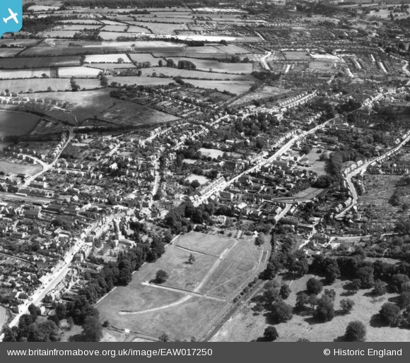
EAW017250 ENGLAND (1948). The town, Hemel Hempstead, 1948. This image has been produced from a print.
© Copyright OpenStreetMap contributors and licensed by the OpenStreetMap Foundation. 2026. Cartography is licensed as CC BY-SA.
Nearby Images (12)
EAW017250

EPW022457

EPW052869

EPW052865
, Hemel Hempstead, 1937")
EAW014884

EPW052866
 and environs, Hemel Hempstead, 1937")
EAW014883

EPW017818

EPW022456

EPW052868

EAW017251

EAW017252

Details
| Title | [EAW017250] The town, Hemel Hempstead, 1948. This image has been produced from a print. |
| Reference | EAW017250 |
| Date | 20-July-1948 |
| Link | |
| Place name | HEMEL HEMPSTEAD |
| Parish | |
| District | |
| Country | ENGLAND |
| Easting / Northing | 505564, 207495 |
| Longitude / Latitude | -0.4704202301147, 51.755729716784 |
| National Grid Reference | TL056075 |
