
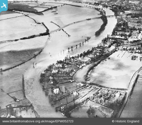
EPW052723 ENGLAND (1937). The River Thames in flood near Riversdale, Bourne End, 1937. This image has been produced from a copy negative.
© Copyright OpenStreetMap contributors and licensed by the OpenStreetMap Foundation. 2025. Cartography is licensed as CC BY-SA.
Nearby Images (6)
EPW052723

EAW034760

EAW034764

EAW034762

EAW003831

EPW052582

Details
| Title | [EPW052723] The River Thames in flood near Riversdale, Bourne End, 1937. This image has been produced from a copy negative. |
| Reference | EPW052723 |
| Date | 20-March-1937 |
| Link | |
| Place name | BOURNE END |
| Parish | WOOBURN |
| District | |
| Country | ENGLAND |
| Easting / Northing | 489420, 186130 |
| Longitude / Latitude | -0.70973775992273, 51.56646990555 |
| National Grid Reference | SU894861 |
Pins
Be the first to add a comment to this image!