
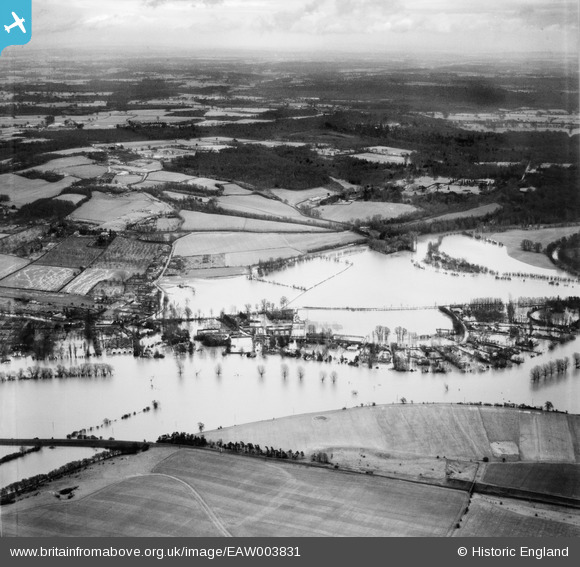
EAW003831 ENGLAND (1947). Flooding around Ferry Lane, Bourne End, from the west, 1947
© Copyright OpenStreetMap contributors and licensed by the OpenStreetMap Foundation. 2025. Cartography is licensed as CC BY-SA.
Nearby Images (5)
EAW003831

EAW034764

EPW052723

EAW034760

EAW034762

Details
| Title | [EAW003831] Flooding around Ferry Lane, Bourne End, from the west, 1947 |
| Reference | EAW003831 |
| Date | 19-March-1947 |
| Link | |
| Place name | BOURNE END |
| Parish | WOOBURN |
| District | |
| Country | ENGLAND |
| Easting / Northing | 489564, 186275 |
| Longitude / Latitude | -0.70762355429614, 51.567750613443 |
| National Grid Reference | SU896863 |
Pins
Be the first to add a comment to this image!