
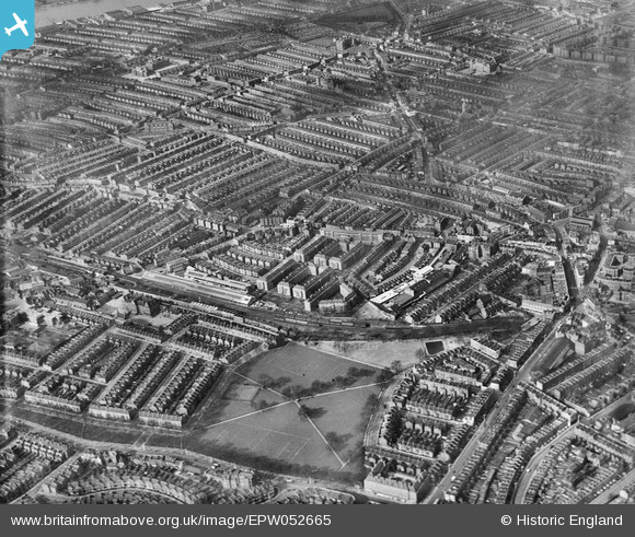
EPW052665 ENGLAND (1937). Eel Brook Common and surrounding residential area, Parsons Green, from the south-east, 1937
© Copyright OpenStreetMap contributors and licensed by the OpenStreetMap Foundation. 2026. Cartography is licensed as CC BY-SA.
Nearby Images (3)
EPW052665

EPW052677

EPW052674

Details
| Title | [EPW052665] Eel Brook Common and surrounding residential area, Parsons Green, from the south-east, 1937 |
| Reference | EPW052665 |
| Date | 12-March-1937 |
| Link | |
| Place name | PARSONS GREEN |
| Parish | |
| District | |
| Country | ENGLAND |
| Easting / Northing | 525427, 176854 |
| Longitude / Latitude | -0.19372512323698, 51.476237230427 |
| National Grid Reference | TQ254769 |
Pins

yes |
Friday 14th of February 2025 11:48:11 PM | |
|
yes |
Friday 14th of February 2025 11:46:33 PM | |
|
Keith Cheriton |
Tuesday 14th of November 2017 03:34:12 PM | |
|
Keith Cheriton |
Tuesday 14th of November 2017 03:32:22 PM | |
|
Keith Cheriton |
Thursday 6th of February 2014 03:47:51 PM | |
|
Keith Cheriton |
Thursday 6th of February 2014 03:45:26 PM | |
|
Keith Cheriton |
Thursday 6th of February 2014 03:43:43 PM | |
|
Keith Cheriton |
Thursday 6th of February 2014 03:42:53 PM | |
|
Keith Cheriton |
Thursday 6th of February 2014 03:41:35 PM | |
|
Keith Cheriton |
Thursday 6th of February 2014 03:40:33 PM |