
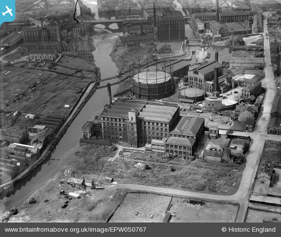
EPW050767 ENGLAND (1936). The Samuel Driver Ltd Warehouse and surrounding industrial works, Brighouse, 1936
© Copyright OpenStreetMap contributors and licensed by the OpenStreetMap Foundation. 2026. Cartography is licensed as CC BY-SA.
Nearby Images (7)
EPW050767

EPW050766

EPW050768

EPW050762

EPW050765

EPW050763

EPW050764

Details
| Title | [EPW050767] The Samuel Driver Ltd Warehouse and surrounding industrial works, Brighouse, 1936 |
| Reference | EPW050767 |
| Date | June-1936 |
| Link | |
| Place name | BRIGHOUSE |
| Parish | |
| District | |
| Country | ENGLAND |
| Easting / Northing | 415053, 422592 |
| Longitude / Latitude | -1.7719746005155, 53.699321551694 |
| National Grid Reference | SE151226 |
Pins

Chris Helme |
Friday 23rd of October 2020 09:32:22 PM |