
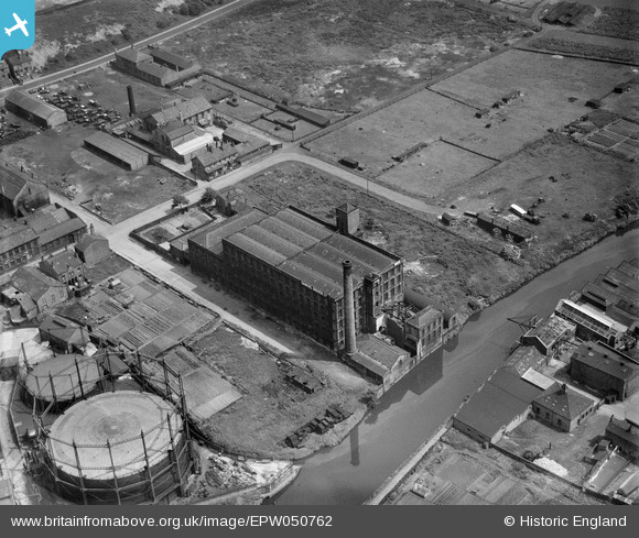
EPW050762 ENGLAND (1936). The Samuel Driver Ltd Warehouse, Brighouse, 1936
© Copyright OpenStreetMap contributors and licensed by the OpenStreetMap Foundation. 2026. Cartography is licensed as CC BY-SA.
Nearby Images (7)
EPW050762

EPW050765

EPW050768

EPW050767

EPW050766

EPW050764

EPW050763

Details
| Title | [EPW050762] The Samuel Driver Ltd Warehouse, Brighouse, 1936 |
| Reference | EPW050762 |
| Date | June-1936 |
| Link | |
| Place name | BRIGHOUSE |
| Parish | |
| District | |
| Country | ENGLAND |
| Easting / Northing | 415046, 422585 |
| Longitude / Latitude | -1.7720809767244, 53.699258829838 |
| National Grid Reference | SE150226 |
Pins
Be the first to add a comment to this image!