
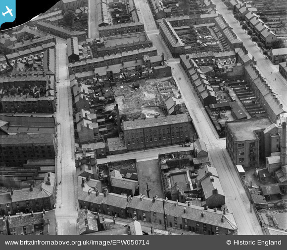
EPW050714 ENGLAND (1936). The Henderson Street Silk Mill and the surrounding residential area, Macclesfield, 1936. This image has been produced from a damaged negative.
© Copyright OpenStreetMap contributors and licensed by the OpenStreetMap Foundation. 2026. Cartography is licensed as CC BY-SA.
Nearby Images (16)
EPW050714

EPW050711

EPW050715

EPW050713

EPW050712

EPW050716

EPW016738

EAW018050

EAW018055

EAW018053

EAW018052

EAW018051

EAW018054

EAW018049

EAW018056

EPW054378

Details
| Title | [EPW050714] The Henderson Street Silk Mill and the surrounding residential area, Macclesfield, 1936. This image has been produced from a damaged negative. |
| Reference | EPW050714 |
| Date | June-1936 |
| Link | |
| Place name | MACCLESFIELD |
| Parish | |
| District | |
| Country | ENGLAND |
| Easting / Northing | 391382, 373369 |
| Longitude / Latitude | -2.1291961350134, 53.256978673256 |
| National Grid Reference | SJ914734 |
Pins
Be the first to add a comment to this image!