
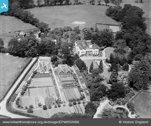
EPW050688 ENGLAND (1936). Bonis Hall, Prestbury, 1936
© Copyright OpenStreetMap contributors and licensed by the OpenStreetMap Foundation. 2026. Cartography is licensed as CC BY-SA.
Nearby Images (5)
EPW050688

EPW050686

EPW050687

EPW050685

EPW050689

Details
| Title | [EPW050688] Bonis Hall, Prestbury, 1936 |
| Reference | EPW050688 |
| Date | June-1936 |
| Link | |
| Place name | PRESTBURY |
| Parish | PRESTBURY |
| District | |
| Country | ENGLAND |
| Easting / Northing | 390302, 378939 |
| Longitude / Latitude | -2.1455568673559, 53.307033003432 |
| National Grid Reference | SJ903789 |
Pins

John Ellis |
Sunday 28th of August 2016 09:16:45 PM |